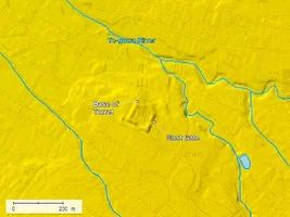
Koyama Castle (小山城 Koyama-jō) was constructed atop a small hill at the northern edge of the Asakawa alluvial fan in what is now Fuefuki City in Yamanashi Prefecture.
By the Eishō era (永正, 1504-1521), the castle had come under the control of Anayama Nobunaga (穴山信永), who was a member of the powerful Anayama clan, a cadet branch of the Takeda. In Daiei 3 (大永三年, 1523), Nobunaga engaged in battle with Nanbu Munehide (南部宗秀), who had crossed the Torisaka Pass (鳥坂峠) from the north. The two armies clashed at Hanatoriyama (花鳥山), after which Nobunaga retreated to Koyama Castle, where he mounted a determined defence, though in vain: the castle eventually fell. Following its capture, it came under the control of the Nanbu clan (南部氏), who controlled the surrounding region.
In Tenbun 17 (天文十七年, 1548), Nanbu Munehide was expelled by Takeda Shingen (武田信玄, 1521-1573) on grounds of misconduct and lawlessness (乱行 rankō). As a result, Koyama Castle was abandoned. This reflects the centralising policies of Shingen, who was systematically consolidating his control over Kai Province (甲斐国 Kai no kuni) and eliminating autonomous warlords or wayward retainers who might destabilise his domain.
Several decades later, during the conflict known as the Tenshō-Jingo Rebellion (天正壬午の乱) in 1582, Tokugawa Ieyasu (徳川家康, 1543–1616) is said to have ordered Torii Mototada (鳥居元忠, 1539–1600) to repair and fortify the ruins of Koyama Castle. This was part of a broader defensive strategy against the Hōjō forces (北条勢) occupying Misaka Castle (御坂城) to the south, in the wake of the sudden collapse of the Takeda clan following Oda Nobunaga 's invasion of Kai.
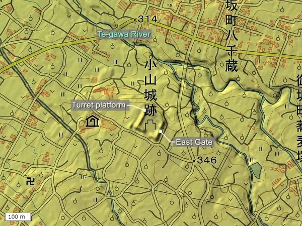
Aerial photographs taken from the Geographical Survey Institute maps. The location of the enclosures is estimated.
As for the east gate (東門), although there is no designated car park, there is a small space in front of the gate where vehicles can be parked.
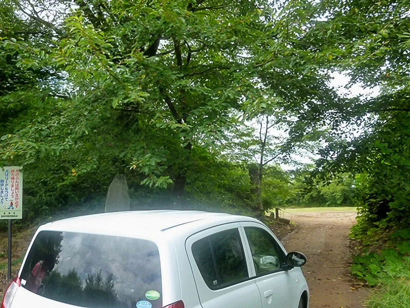
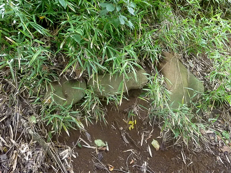
It is said that some stonework (石組み ishigumi) remains at the east gate (東門), but with my eyesight, I was unable to locate it. I did come across something, but I don't believe it was the actual remnant in question...
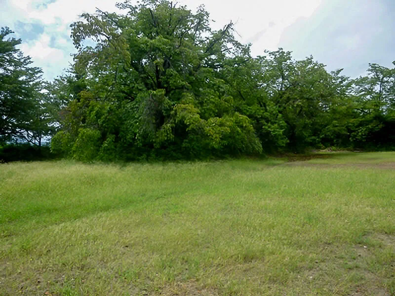
The earthen ramparts (土塁) on all four sides remain almost perfectly intact.
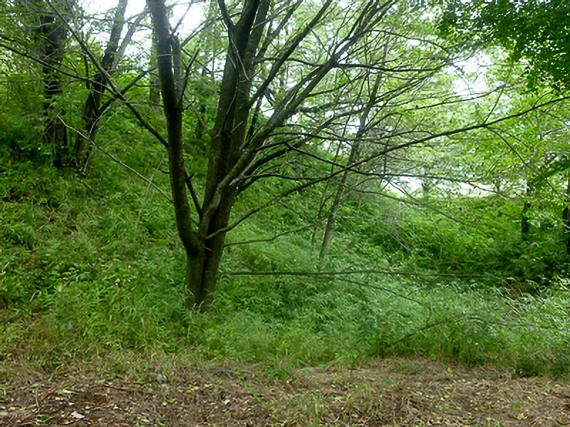
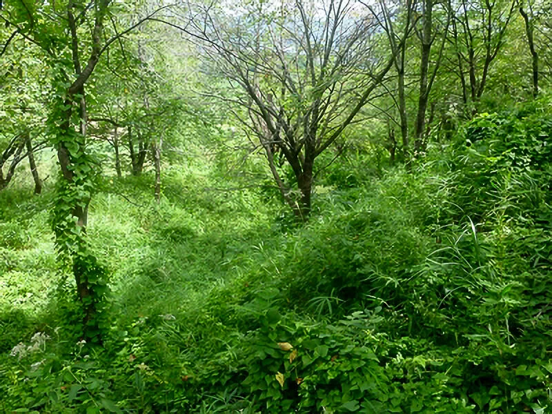
I discovered a section where the ramparts form a double-layered structure (二重土塁). It's a bit difficult to distinguish, but the area around the tree in the centre marks the bottom of the trench (堀), while the left side is the outer rampart (土塁).
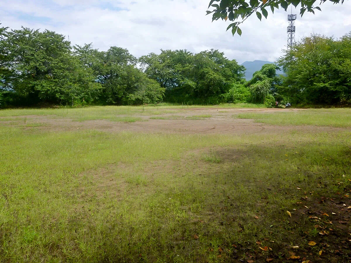
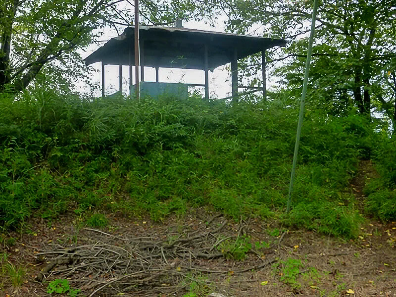
The area at the northern end where the gazebo stands marks the site of the yaguradai (櫓台), or turret platform. Foundation stones (礎石 Soseki) have been discovered there, indicating the former presence of a defensive structure.
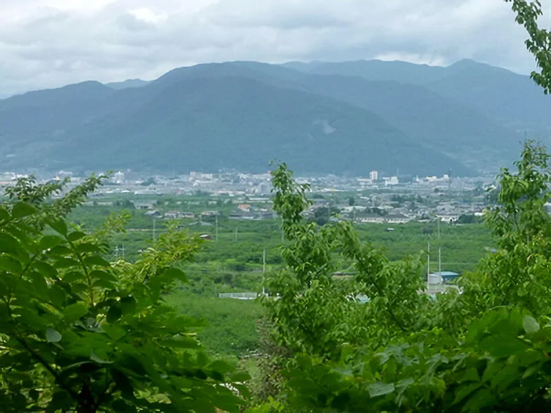
The view from the yaguradai (櫓台) facing north reveals a gentle slope descending toward the central part of the Kōfu Basin (甲府盆地 Kōfu bonchi).
Date of visit: 16 August 2014
History:
The exact date of its founding remains unclear, but historical records indicate that by Hōtoku 2 (宝徳二年, 1450), Anayama Izu-no-kami (穴山伊豆守) had taken up residence there. During that time, he launched an attack on the residence of Takeda Nobushige (武田信重, 1386-1450) in Koisawa (小石和), which suggests that the castle was already a functional stronghold by the mid-15th century, serving as a base of operations in local conflicts.By the Eishō era (永正, 1504-1521), the castle had come under the control of Anayama Nobunaga (穴山信永), who was a member of the powerful Anayama clan, a cadet branch of the Takeda. In Daiei 3 (大永三年, 1523), Nobunaga engaged in battle with Nanbu Munehide (南部宗秀), who had crossed the Torisaka Pass (鳥坂峠) from the north. The two armies clashed at Hanatoriyama (花鳥山), after which Nobunaga retreated to Koyama Castle, where he mounted a determined defence, though in vain: the castle eventually fell. Following its capture, it came under the control of the Nanbu clan (南部氏), who controlled the surrounding region.
In Tenbun 17 (天文十七年, 1548), Nanbu Munehide was expelled by Takeda Shingen (武田信玄, 1521-1573) on grounds of misconduct and lawlessness (乱行 rankō). As a result, Koyama Castle was abandoned. This reflects the centralising policies of Shingen, who was systematically consolidating his control over Kai Province (甲斐国 Kai no kuni) and eliminating autonomous warlords or wayward retainers who might destabilise his domain.
Several decades later, during the conflict known as the Tenshō-Jingo Rebellion (天正壬午の乱) in 1582, Tokugawa Ieyasu (徳川家康, 1543–1616) is said to have ordered Torii Mototada (鳥居元忠, 1539–1600) to repair and fortify the ruins of Koyama Castle. This was part of a broader defensive strategy against the Hōjō forces (北条勢) occupying Misaka Castle (御坂城) to the south, in the wake of the sudden collapse of the Takeda clan following Oda Nobunaga 's invasion of Kai.
Layout:
Although some portions of the southern rampart (土塁 dorui) have been levelled, much of the original fortification remains well-preserved today. The northern side of the castle faced a cliff overlooking the Te-gawa River (天川), making it a natural defensive barrier. Defensive moats (堀 hori) were constructed on the remaining three sides, underscoring the strategic thought behind the layout of this mountain fortification.Aerial photographs taken from the Geographical Survey Institute maps. The location of the enclosures is estimated.
Report:
I went there by car. However, since the site is not located on a particularly prominent hill and is surrounded by many narrow roads, it is challenging to find. For the time being, I used the Koyamasō (小山荘) nursing home as a landmark. From there, heading approximately 200 metres east, there is an open area resembling a sports ground—this is the location of the former castle site (城跡 shiroato).As for the east gate (東門), although there is no designated car park, there is a small space in front of the gate where vehicles can be parked.
It is said that some stonework (石組み ishigumi) remains at the east gate (東門), but with my eyesight, I was unable to locate it. I did come across something, but I don't believe it was the actual remnant in question...
The earthen ramparts (土塁) on all four sides remain almost perfectly intact.
I discovered a section where the ramparts form a double-layered structure (二重土塁). It's a bit difficult to distinguish, but the area around the tree in the centre marks the bottom of the trench (堀), while the left side is the outer rampart (土塁).
The area at the northern end where the gazebo stands marks the site of the yaguradai (櫓台), or turret platform. Foundation stones (礎石 Soseki) have been discovered there, indicating the former presence of a defensive structure.
The view from the yaguradai (櫓台) facing north reveals a gentle slope descending toward the central part of the Kōfu Basin (甲府盆地 Kōfu bonchi).
Date of visit: 16 August 2014
Access:
- Address: Yatsushirocho Koka, Fuefuki, Yamanashi 406-0831
- Access: From JR Chūō Main Line (JR中央本線), take the Fuefuki City Ashigawa Bus (笛吹市営芦川バス) from Isawa-Onsen Station (石和温泉駅), get off at the Misaka Nishi Elementary School stop (御坂西小学校前), and walk for 15 minutes. If coming by car, it is approximately 3 kilometres from the Ichinomiya-Misaka Interchange (一宮御坂IC) on the Chūō Expressway (中央道), via Prefectural Route 211 (県道211号線).
- Parking: None (there is a parking space available in front of the east gate (東門).