

Sukagawa Castle (須賀川城 Sukagawa-jō) was a flatland castle (平城 hirajiro) built in what is now Sukagawa in Fukushima Prefecture . The castle was constructed in 1448 by Nikaidō Tameuji (二階堂為氏), a local warlord who controlled much of Iwase District. The Nikaidō clan had long been one of the region's dominant military families during the Muromachi period .
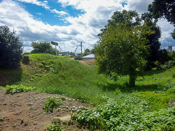
The castle is best remembered for the siege that brought about the destruction of the Nikaidō clan during the late Sengoku period . In 1589, Date Masamune (伊達政宗, 1567–1636) launched an attack on Sukagawa Castle as part of his campaign to expand Date influence across southern Mutsu Province.
At the time, the effective ruler of the castle was Daijō-in (大乗院), the wife of Nikaidō Moriyoshi (二階堂盛義). After the deaths of both her husband and her son in quick succession, she had assumed responsibility for governing the domain. Daijō-in herself was connected to the Date clan by birth. Because of this, Masamune initially sought to settle the matter peacefully, calling for reconciliation rather than immediate battle.
Resistance within the castle and surrounding town, however, proved stronger than expected. According to tradition, retainers and townspeople gathered during the night on Mount Gorōzan (五老山), east of the castle, carrying burning torches as they assembled. There, they resolved to resist the Date forces and urged Daijō-in to reject Masamune's overtures. Accepting their advice, she chose to fight.
The siege that followed was fierce. Nikaidō defenders fought desperately after Date troops forced their way into the castle. In the end, the defence collapsed when Moriya Chikugo-no-kami (守谷筑後守), who had secretly sided with the enemy, set fire to the castle from within. The resulting confusion broke the resistance, and Sukagawa Castle fell. With its defeat, the Nikaidō clan was effectively destroyed.
Daijō-in survived the fall of the castle and was rescued from the fighting. She was later placed under the protection of the Iwaki and Satake families before eventually returning to the Sukagawa area, where she died.
The memory of the siege remained strong locally. Sukagawa still holds the Taimatsu Myōjin Torch Festival, better known today as the Taimatsu Akashi (松明あかし), a fire festival said to commemorate those who died in the castle's fall and the destruction of the Nikaidō clan.
Sukagawa Castle did not survive into the later Edo period as an active military stronghold. It was abandoned in the early seventeenth century, after the establishment of Tokugawa rule reduced the need for many regional fortifications. The surrounding area later developed into a prosperous post town along important transport routes through the region.
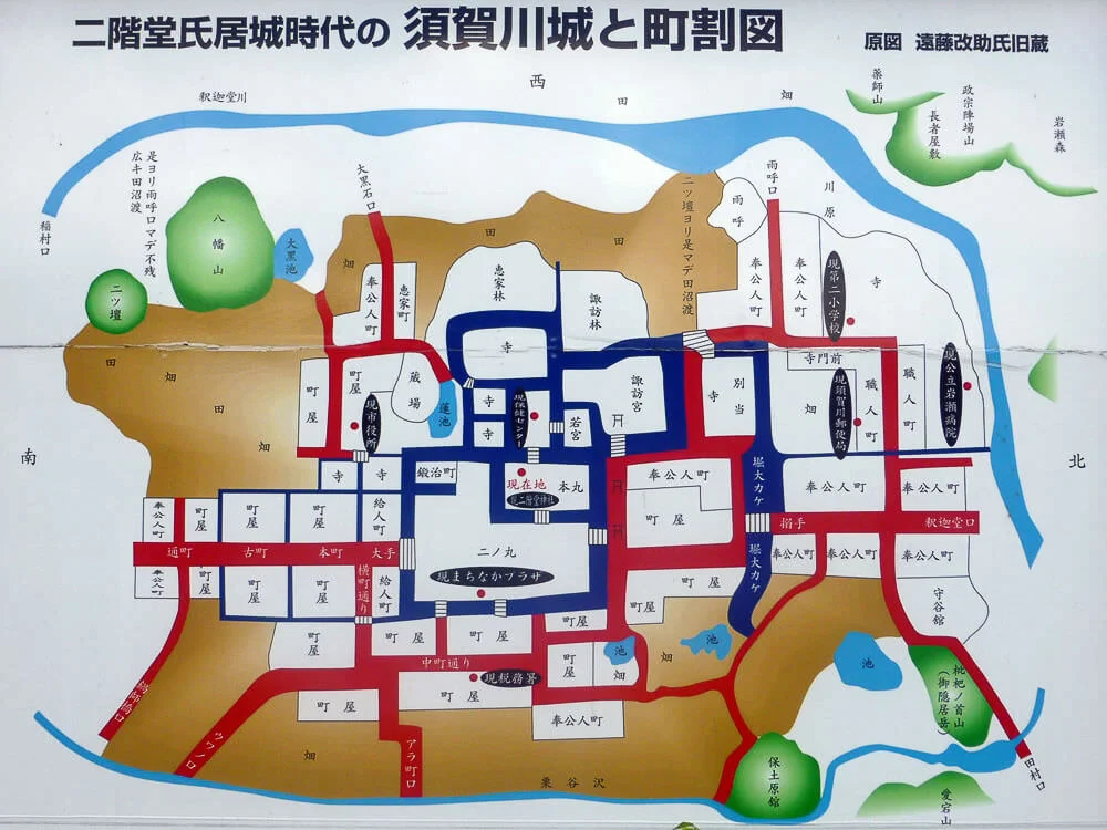
Below is a map of Sukagawa Castle as it appeared at the time.
Like many flatland castles, most of Sukagawa Castle's remains have disappeared due to urban development. Only a few traces survive today, mainly within the grounds of Chōshō-in (長松院) and Otakiya Shrine (神炊館神社).
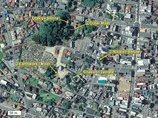
We first headed to the site of Nikaidō Shrine, located within the former inner bailey.
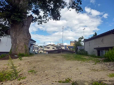
➢ ① Former site of Nikaidō Shrine (二階堂神社跡)
However, the shrine itself had apparently been removed, possibly due to damage from the Great East Japan Earthquake.
(Later, the shrine was rebuilt in 2015.)
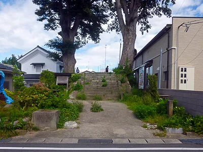
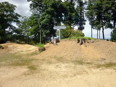
Only the earthen ramparts (土塁 dorui) remain.
➢ ② Otakiya Shrine (神炊館神社)
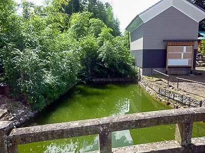
At Otakiya Shrine on the north-western side of the former inner bailey, there is a pond that makes use of the remains of the outer moat.
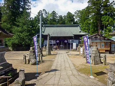
This is the main shrine building of Otakiya Shrine (神炊館神社).
➢ ③ Chōshō-in (長松院)
The most substantial surviving remains of Sukagawa Castle can be found at Chōshō-in. Earthen ramparts (土塁 dorui) and traces of the moat still survive here in relatively good condition. According to surveys, the ramparts are approximately 5.5 metres high, while the moat is around 2 metres deep.
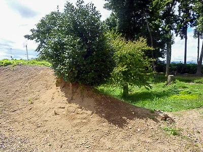
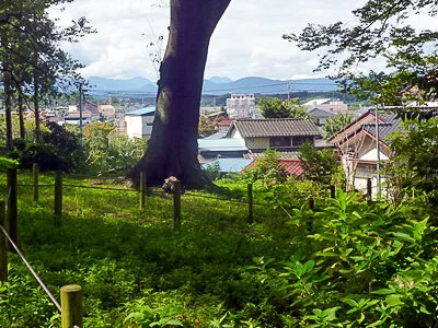
Looking around the area, it is still clear that the site stands on slightly elevated ground.
Date of visit: 13 September 2014
The castle is best remembered for the siege that brought about the destruction of the Nikaidō clan during the late Sengoku period . In 1589, Date Masamune (伊達政宗, 1567–1636) launched an attack on Sukagawa Castle as part of his campaign to expand Date influence across southern Mutsu Province.
At the time, the effective ruler of the castle was Daijō-in (大乗院), the wife of Nikaidō Moriyoshi (二階堂盛義). After the deaths of both her husband and her son in quick succession, she had assumed responsibility for governing the domain. Daijō-in herself was connected to the Date clan by birth. Because of this, Masamune initially sought to settle the matter peacefully, calling for reconciliation rather than immediate battle.
Resistance within the castle and surrounding town, however, proved stronger than expected. According to tradition, retainers and townspeople gathered during the night on Mount Gorōzan (五老山), east of the castle, carrying burning torches as they assembled. There, they resolved to resist the Date forces and urged Daijō-in to reject Masamune's overtures. Accepting their advice, she chose to fight.
The siege that followed was fierce. Nikaidō defenders fought desperately after Date troops forced their way into the castle. In the end, the defence collapsed when Moriya Chikugo-no-kami (守谷筑後守), who had secretly sided with the enemy, set fire to the castle from within. The resulting confusion broke the resistance, and Sukagawa Castle fell. With its defeat, the Nikaidō clan was effectively destroyed.
Daijō-in survived the fall of the castle and was rescued from the fighting. She was later placed under the protection of the Iwaki and Satake families before eventually returning to the Sukagawa area, where she died.
The memory of the siege remained strong locally. Sukagawa still holds the Taimatsu Myōjin Torch Festival, better known today as the Taimatsu Akashi (松明あかし), a fire festival said to commemorate those who died in the castle's fall and the destruction of the Nikaidō clan.
Sukagawa Castle did not survive into the later Edo period as an active military stronghold. It was abandoned in the early seventeenth century, after the establishment of Tokugawa rule reduced the need for many regional fortifications. The surrounding area later developed into a prosperous post town along important transport routes through the region.
Below is a map of Sukagawa Castle as it appeared at the time.
Like many flatland castles, most of Sukagawa Castle's remains have disappeared due to urban development. Only a few traces survive today, mainly within the grounds of Chōshō-in (長松院) and Otakiya Shrine (神炊館神社).
The aerial photograph is based on the Geospatial Information Authority of Japan's GSI Maps. The locations of the kuruwa (曲輪) and other castle features are conjectural and may not be exact.
We first headed to the site of Nikaidō Shrine, located within the former inner bailey.
➢ ① Former site of Nikaidō Shrine (二階堂神社跡)
However, the shrine itself had apparently been removed, possibly due to damage from the Great East Japan Earthquake.
(Later, the shrine was rebuilt in 2015.)
Only the earthen ramparts (土塁 dorui) remain.
➢ ② Otakiya Shrine (神炊館神社)
At Otakiya Shrine on the north-western side of the former inner bailey, there is a pond that makes use of the remains of the outer moat.
This is the main shrine building of Otakiya Shrine (神炊館神社).
➢ ③ Chōshō-in (長松院)
The most substantial surviving remains of Sukagawa Castle can be found at Chōshō-in. Earthen ramparts (土塁 dorui) and traces of the moat still survive here in relatively good condition. According to surveys, the ramparts are approximately 5.5 metres high, while the moat is around 2 metres deep.
Looking around the area, it is still clear that the site stands on slightly elevated ground.
Date of visit: 13 September 2014
Access:
- Address: Suwamachi, Sukagawa, Fukushima Prefecture 962-0847
- Access: The site is about an 18-minute walk from Sukagawa Station on the JR Tōhoku Main Line. By car, it is approximately 3 kilometres from the Sukagawa Interchange on the Tōhoku Expressway via National Route 118.
- Parking: Parking is available at Chōshō-in (長松院) or at the Otakiya Shrine (神炊館神社) car park (free of charge; marked "P" on the map above).


