News M7.6 earthquake jolts Sea of Japan coast (Noto Peninsula Earthquake)

Despite effort of scientist, it is not obvious when and where will happen an earthquake, but in some situations, some signs can help in this way, as I predicted two quakes in Australia and now in Japan, last year, based on some phenomenons and activities in the ground and also some earthquakes in the area between Australia, Indonesia, Philippine and other places in the area that I don't remember now.

Among my predictions, I showed a new big hole in the shores of Australia and warned, an earthquake is going to happen in Australia that seemed to be unbelievable, but it took place later.

Please be in caution; a disaster is in the way!

I think I turned on a red light about an intense quake in Japan, based on my scientific sense, as well.
 
Last edited:
Space photos show Japan's 7.6-magnitude earthquake lifted land out of the sea, extending parts of its coastline by as much as 2 football fields

Space photos show Japan's 7.6-magnitude earthquake lifted land out of the sea, extending parts of its coastline by as much as 2 football fields
Morgan McFall-JohnsenJan 6, 2024, 8:06 AM GMT+9
  • Japan's Noto Peninsula has newly exposed beaches due to the earthquake that struck Monday.
  • The quake raised land along the coast, extending the coastline by up to 820 feet in some places.
  • Locals who were fishing at the time, reported the entire coastline uplifted when the quake hit.

According to satellite imagery, Japan's Noto Peninsula was rattled and slightly enlarged when a 7.6-magnitude earthquake struck on January 1.
Preliminary satellite analysis and on-the-ground surveys have found that the earthquake raised land along the coast — a process called uplift — by as much as 4 meters, roughly 13 feet.
That means the sea floor along the coast has now risen above the water in many places on the Noto Peninsula, creating newly exposed beaches.
In some places, the earthquake extended the coastline by as much as 250 meters, or about 820 feet, according to a statement from the University of Tokyo. That's about the length of 2.2 American football fields.
Locals fishing in a bay on the peninsula reported that "the entire coastline was uplifted at the time of the earthquake, that the uplift in the bay occurred at the same time as the earthquake, and that the tsunami in the bay did not run up to the raised port," the university's statement said, according to a Google translation from Japanese to English.
The Geospatial Information Authority of Japan published a preliminary satellite analysis of the Noto Peninsula. Comparing satellite images from June 2023 with images from the days after the earthquake, the agency identified multiple regions where new coastline has emerged.
 
Not directly related, but this shouldn't go unnoticed:


North Korean leader Kim Jong Un has sent a "message of sympathy" to Prime Minister Fumio Kishida following the devastating earthquake in Ishikawa Prefecture earlier this week that has left 100 people dead and more than 200 missing. The North's official Korean Central News Agency (KCNA) said in a short dispatch Saturday that Kim had "expressed his deep sympathy and condolences to the prime minister and, through him, to the bereaved families and victims" a day earlier. In the extremely rare communication between the two countries' leaders — Kim's first to Kishida — the North Korean strongman said he "sincerely hoped that the people in the affected areas would ... restore their stable life at the earliest date possible."

 
Space photos show Japan's 7.6-magnitude earthquake lifted land out of the sea, extending parts of its coastline by as much as 2 football fields

Space photos show Japan's 7.6-magnitude earthquake lifted land out of the sea, extending parts of its coastline by as much as 2 football fields
Morgan McFall-JohnsenJan 6, 2024, 8:06 AM GMT+9
  • Japan's Noto Peninsula has newly exposed beaches due to the earthquake that struck Monday.
  • The quake raised land along the coast, extending the coastline by up to 820 feet in some places.
  • Locals who were fishing at the time, reported the entire coastline uplifted when the quake hit.

According to satellite imagery, Japan's Noto Peninsula was rattled and slightly enlarged when a 7.6-magnitude earthquake struck on January 1.
Preliminary satellite analysis and on-the-ground surveys have found that the earthquake raised land along the coast — a process called uplift — by as much as 4 meters, roughly 13 feet.
That means the sea floor along the coast has now risen above the water in many places on the Noto Peninsula, creating newly exposed beaches.
In some places, the earthquake extended the coastline by as much as 250 meters, or about 820 feet, according to a statement from the University of Tokyo. That's about the length of 2.2 American football fields.
Locals fishing in a bay on the peninsula reported that "the entire coastline was uplifted at the time of the earthquake, that the uplift in the bay occurred at the same time as the earthquake, and that the tsunami in the bay did not run up to the raised port," the university's statement said, according to a Google translation from Japanese to English.
The Geospatial Information Authority of Japan published a preliminary satellite analysis of the Noto Peninsula. Comparing satellite images from June 2023 with images from the days after the earthquake, the agency identified multiple regions where new coastline has emerged.

This probable phenomenon is not a sign that a land added to the points of the coastline, but it can be due two reasons:

1- The landslides during happening the earthquake, whether on the ground or under grounds

2- Occurring some cracks and creating some gaps underground that derived the grounds toward the sea.

This phenomenon can be worrying in the future, because the cracks and gaps underground provide a context for occurring some other earthquakes in the future due to weakness of the bottom layers of the grounds in the area.

Appearing an Island in the sea whether is because of an undersea volcano activity or a complex pressures of different grounds with different structures that apply to each other in a long term, thousands or millions years.

Of course, a massive quake can do that in the shallow waters too, but it is due to the sudden replacement of the grounds with some undetectable cracks.

Based on the news; In recent quake in Japan, the replacements and cracks happened in the land, not sea.
 
This probable phenomenon is not a sign that a land added to the points of the coastline, but it can be due two reasons:

1- The landslides during happening the earthquake, whether on the ground or under grounds

2- Occurring some cracks and creating some gaps underground that derived the grounds toward the sea.

This phenomenon can be worrying in the future, because the cracks and gaps underground provide a context for occurring some other earthquakes in the future due to weakness of the bottom layers of the grounds in the area.

Appearing an Island in the sea whether is because of an undersea volcano activity or a complex pressures of different grounds with different structures that apply to each other in a long term, thousands or millions years.

Of course, a massive quake can do that in the shallow waters too, but it is due to the sudden replacement of the grounds with some undetectable cracks.

Based on the news; In recent quake in Japan, the replacements and cracks happened in the land, not sea.
Yes there were landslides too but it's clear that the primary reason is because the land/elevation rose by up to 4 meters in some locations.
You can see it on the interactive photo tool here. And one example below:

BEFORE
1704567307006.webp


AFTER
1704567254236.webp
 
So we should consider this phenomenon, rising ground in the shore, not advancing or extending land toward the sea.

Nevertheless, the result is the same; replacement the ground layers in the bottom. Probably because of a hidden and closed volcanic activity that caused the quake, or a massive and sudden pressure from the sea bed toward the coastline.

Also, has the reporter source considered the monthly sea tides?
 
Last edited:
Also, has the reporter source considered the monthly sea tides?
They measured the vertical displacement using radio waves (radar) from satellites. I'm not sure about the tide cycle for those particular photos. Anyway there's no reason to doubt the news reports which are backed by satellite images.
 
Tho higher at the ends (korean strait and tsugaru) tides are extremely small in this part of the sea of japan. Like usually 10cm (amplitude), occasionally 20, while 30cm is infrequent. This is forward-looking, not back, but there are probably as many days with 0cm 'tide' as there are with 30cm.

This is Mina-Tsuki, administratively part of Wajima, but west of Wajima city there at the top of the peninsula. This has absolutely zero to do with any tide.

mina-tsuki.webp
 
[Noto Peninsula earthquake] I cannot observe it by the ground upheaval at a tsunami observation point of the setting in "bottom of the sea exposure" Ishikawa, Suzu.


According to the Meteorological Agency, the state that cannot obtain the observation data of the tide level after the Noto Peninsula earthquake which occurred per day continues in tsunami observation point "Suzu-shi Nagahashi" installing in Suzu-shi, Ishikawa.

After confirming the aerial photo which Geographical Survey Institute photographed after the earthquake while I did it this way, large-scale crustal movement was up in the whole area of this observation point, and the ground rose, and it was revealed that it was in condition not to be able to observe the bottom of the sea because it was in a condition to have been exposed.

I am doing the influence that a tsunami warning and the warning which the Meteorological Agency announces estimate the scale of the earthquake to be cause based on the data of "the seismometer" and perform it if there is not it. However, observation data are necessary for a change and the cancellation of the warning, and the Meteorological Agency examines an observation point becoming in substitution for neighborhood and is that I push forward work for observation resumption.

By the Noto Peninsula earthquake, up to around 4 meters rises in the western part of Wajima-shi, Ishikawa, and it is revealed that large-scale crustal movement happened in a wide area of Noto Peninsula by the observation using satellites of Geographical Survey Institute.

Ministry of Land, Infrastructure, Transport and Tourism
Geospatial Information Authority of Japan

Crustal Movement in Japan

I establish "the electronic control point" about 1,300 points every national about 20km for the purpose of surveying or crustal movement monitoring in Geographical Survey Institute. The electronic threshold observes a signal transmitted by a GPS satellite and an artificial satellite (GNSS satellite) for the pinpointing including guidance (the associate zenith satellite system). A correct position on the earth of the electronic threshold understands that I analyze observation data.
The earth crust which composes an earth surface because plural plates clash increases complicated power, and large and small crustal movement such as an upheaval, sedimentation, movement gets up, and in a short time big crustal movement occurs in around Japanese Islands by a major earthquake and volcanic activity, and I hang long time, and a mountain range rises, and there is the case that a coastal place subsides.
In Geographical Survey Institute, I check the change of the daily positions of the national electronic threshold in detail and collect the data which are necessary for predictions of a mechanism elucidation and the volcanic activity of the earthquake by watching the movement of the country and provide information.


The Japanese Islands which move.
The national horizontal crustal movement that I demanded in an electronic threshold.
From April, 1997 to April, 2022
 
The port is unusable due to the rise of the sea floor.

[Noto Peninsula earthquake] January 4, 2024
A transportation warship of the Marine Self Defense Force starts the transportation including the heavy industrial machine.


It is operational start NTT DOCOMO and KDDI | of the base station in a ship at the Wajima-shi coast TBS NEWS DIG


NTT DOCOMO and KDDI announced that they began the operation of the base station on the ship at the coast of Wajima-shi, Ishikawa while a communication disorder continued at a stricken area of the Noto Peninsula earthquake. If it is less than several kilos of the ship, it means that a cell-phone is usable.

According to announcement, NTT DOCOMO and KDDI are that they started the operation of the base station in the ship using the facilities of the cell-phone base station of the bottom of the sea cable ship "bond" near the Wajima, Ishikawa municipalities Nomachi coast from the afternoon of 6th.

It means that a cell-phone is usable from a ship by sending the electric wave which I received with satellite dish from a ship if it is up to less than several kilometers.


As I cannot use it for inland communication in the marine base station.
There was it for the article of this site.
The early practical use of the net is expected in an unmanned aircraft base station.
 
I had a research in the internet and based on analyzing some information I reached this conclusion that a connection is between the recent quake in peninsula and the eruption in Sakurajima Island in 2023.

I think, the Showa carter expressed something last year that will happen somewhere in Japan.

Such sign that is an announcement about an event in the future cannot be ignored,. But when nature is going to send a dark shadow on an area of the earth, we have no choice unless to take refuge in God, Beforehand.


sakurajima_20091003_pcrl.jpg
 
Astonishing video of the tsunami on the Noto peninsula

Wanted to post this yesterday. 😅

Here's some more disturbing footage:

Wajima landslide


Spooky:


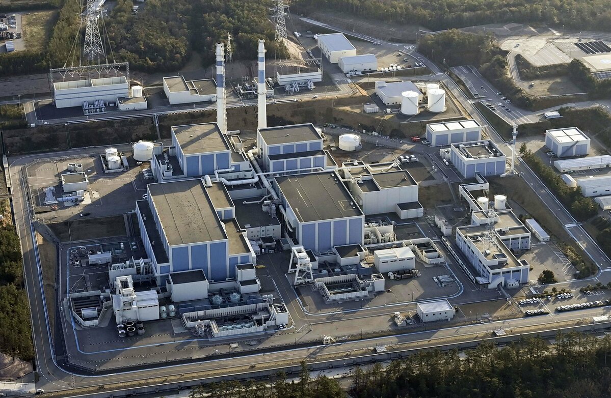
Japan was lucky this time: a three-metre-high tsunami reached the Shika nuclear power plant in Ishikawa Prefecture but caused no major safety problems.

 
I actually wasn't aware that the tsunamis and landslides from this earthquake were so devastating. The news here in the States is all about the earthquake and the fatalities. The impression given is that there was some small tsunami observed, but the news here doesn't go into detail. The same with the landslides. For the past week I've been thinking there was just a lot of shaking and destruction of old houses. And the nuclear power plant...I heard on the news right away that there was no damage. I wasn't aware until today that there was a 3-meter tsunami that hit it.
 
Wanted to post this yesterday. 😅

Here's some more disturbing footage:

Wajima landslide


Spooky:


Japan was lucky this time: a three-metre-high tsunami reached the Shika nuclear power plant in Ishikawa Prefecture but caused no major safety problems.


Very impressive camera work. Most people aren't that great at keeping it steady even when they're not experiencing a disaster.
 
The Nuclear Regulation Authority indicated yesterday that the stress inflicted on the Shika nuclear power plant in Shikamachi, Ishikawa, exceeded the limit anticipated in the facility's design.


9.webp


According to other news, the constant TV reports on the Noto Earthquake seem to create what a social psychologist called 'compassion fatigue'.


Amid concerns of mental fatigue from continued exposure to news program images of collapsed houses and the burning jetliner, the Mainichi Shimbun asked Mafumi Usui, 64, a graduate school professor at Niigata Seiryo University, what precautions to take. Usui pointed out, "'Compassion fatigue' is more likely to occur in adults, who have gone through a variety of experiences and are more prone to empathy, and elderly people need to be careful." Compassion fatigue is a condition in which the mind becomes exhausted from empathizing too much with the pain and suffering of others. It was originally used to describe the mental and physical suffering of medical professionals due to their treating of patients' problems as their own.

 
The nuclear news frightens me. If the power-plants can't be built to withstand Japan's ever-shaking ground, and ever-lashing tsunami, you almost have to write-off all nuclear power for Japan. And doing this means you are chaining Japan to an ever precarious supply-chain of coal and gas and oil. Well, nuclear power chains Japan to its source of uranium, so in any case Japan is going to be reliant on the market for its energy needs. What a nightmare.
Like I said earlier, when the news first broke about the quake, the nuclear power plant situation was given a cursory look, and it seems like the nuclear regulatory agency flashed the "OK" sign, and it disappeared from the news cycle.
Now it turns out that things weren't actually OK, and that this particular plant was stressed beyond its design limit. It's just luck (and maybe some over-engineering) that kept this from being a kind of repeat of 2011. How can Japan ever feel confident in its nuclear industry? Or, why should they ever feel confident in their nuclear industry? (Well, the same can be said for any nuclear-powered nation that has earthquakes - the US included). What a headache.

The other story, about compassion fatigue, I can completely understand. These events just saturate the news cycle to the point where people get sick of it. The broadcasters don't dare break away to any other programming for fear of seeming unserious or insensitive to those affected, and viewers just overdose on disaster news. I think its particularly tough for Japan, where a lot of people are stuck inside during the winter months, with nothing to do but watch the tube or doom scroll.
 
日本全国 緊急地震速報ライブ The Real-time Earthquake Alert Channel for Japan (Tokyo) since

Kushiro of Hokkaido and Choshi, Chiba of Kanto seem to shake frequently.
 
As for nukes, there was one plant that was proposed for, but its construction was tabled (stopped), in Suzu, one of the areas that was hit pretty hard. I've heard/read a few comments to the effect, 'thank goodness they didn't build that.'

My wife said she saw/heard something referencing the 2-4m uplift of the end of the peninsula. An expert on it said that, no, it wouldn't stop, the earthquakes were not over (long term), since the Noto peninsula itself was a result of uplift. And there was no indication that it was done, or that the uplift would not continue.
 
Here's some footage (FNN) showing the land elevations at ports around the Noto Peninsula. Damage has been confirmed in 58 out of 69 ports in the prefecture, with uplift observed in 15 locations.


Where I'm from it's always the opposite - the ocean reclaims the land and people have to move inland. I never even considered it could go this way, too. What a tragedy to marine life and the people who make their living of the ocean but also, at the same time, truly fascinating the powers at play to make this happen.
 
Where I'm from it's always the opposite - the ocean reclaims the land and people have to move inland. I never even considered it could go this way, too. What a tragedy to marine life and the people who make their living of the ocean but also, at the same time, truly fascinating the powers at play to make this happen.
That whole peninsula is the result of land uplifting so it makes sense.
 
Back
Top Bottom