The entire Pacific Ocean floor area seems to show human habitats, roads, canals, agricultural protection zones.
Most significantly, as hard as it may seem to visualize, as contrary to everything we have been taught in all our known history books, I am proposing there are at least 14 massive, longitudinal, Pacific Ocean-floor, organized-man-made highways and canals stretching for the majority of distance from the California coast to Indonesia/Japan/China, from South America to New Zealand, from Antarctica North towards Hawaii, and from the Arctic South to Australia.
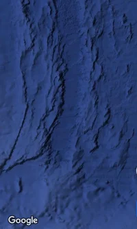
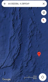
Imageshack 1, the Pacific Ocean, centered on Tahiti. I am proposing that every square mile of this image indicates intense human habitat formations, in addition to 14+ man-made/enhanced roads, canals, agricultural zones stretching East to West, Southwest to Northwest, North to South, etc.

Call them Highways, roads, ツ"Protected Agricultural Zonesツ", habitat protectors, these man-made architected zones vary in width from 2 miles to 120 miles, and stretch thousands of miles long.
Note: Experts may validly call these 14 trans-Pacific routes ツ"fracture zonesツ", and they may have been at one time. Countering this argument, I recognize these ocean-floor anomalies as man-made, man-enhanced, intentionally spaced, architected structures which connect middle of the Pacific locations with the West Coast of America, with the Australia regions, Arctic and Antarctica, and certainly with Asia.
Also note: the legends tell us that Polynesian navigators would ツ"follow the wavesツ". I propose that they were actually ツ"following the waves caused by these ancient structured roadsツ", and the slightly elevated protrusions on the ocean floors which thrust the waves upwards in regular patterns.
Obviously, for the ocean floor trench areas East of Japan, known as the Kuril-Kamchatka Trench as one example, there can be no highway of any kind. But the directional azimuth of these highways seems to end on one side of those trenches and mountain ranges, and resume on the other side.
I am focusing on two of the longest of the roads, from Japan to Baja, and from China to Los Angeles!
ツ"Musashiツ" and ツ"Huangdi-Lei Zuツ" Intercontinental, Pacific Ocean Floor Highways


#1. Huangdi/LeiZu Intercontinental Highway, Shanghai to Los Angeles (red line)
One of those man-made highway/canals/protected zones, starts in California as a 50 mile wide (average) swatch of connected linear structures, stretching from the Los Angeles area, through to North of the Hawaiian Islands, and then in a slight dog-leg motion continues in an average 2-mile-wide, agricultural/highway/canal towards Yaku-Shima Island South of Japan, and onto the Mt. Putuo/Shanghai area of China.
Geographic Note: ツ"Mount Putuo is an island located to the south-east of Shanghai, in Zhoushan prefecture of Zhejiang province, China. It is famous in Chinese Buddhism, and is considered the bodhimanda of Avalokitesvara (Guan Yin), a revered Bodhisattva in many parts of East Asia. Mount Putuo is one of the four sacred mountains in Chinese Buddhism, the others being Mount Wutai, Mount Jiuhua, and Mount Emeiツ"ツ…Wikipedia
#2. Miyamato Musashi Intercontinental Highway: Shikoku , Japan to Bahia Tortugas, Baja Mexico. (green line)
The second intercontinental highway starts in the Shikoku Island area, criss-crosses the Huangdi Highway at 544 miles at 130 degrees southeast of Yokohama, travels East and intersects the Hawaiian Islands at Honolulu, and finishes on the West Coast of Baja Mexico near Bahia Tortugas.

Segment one up close, at the point where the Huangdi Highway criss-crosses the Musashi Highway, 544 miles Southeast of Yokohama at 130 degrees.

Let me repeat my lack of academic standing, my lack of expertise in archaeology, but I strongly suspect, if not emphatically emphasize, I am not the first to know of these man-made structures. I would be happy to describe myself as the 10,000 and first person to find these roads.
But I am only the latest to show the public, not the first, let me leave it at that!
Unless the reader knows something I don't, using better tools than I have, the criss-crossing point of these two ancient highways is only visible in the Google Earth KMZ topographic software provided by the US National Oceanographic and Atmospheric Administration, NOAAツ… downloadable atツ…
[DLMURL]ftp://ftp.ngdc.noaa.gov/mgg/global/relief/ETOPO1/tiled/ice_surface/etopo1_ice_surface.kmz[/DLMURL]
Subsequent parts of this thread will dissect these two intercontinental highways into Segments, the first being the area from South of Chiba Japan 2000 miles East towards what is known as the Gosanjo Seamount.
And I will be presenting the massive human habitat evidence in the deepest parts of the Pacific.
Where legends, historical accounts, and myths come togetherツ… Research notes
Huangdi, also known as the ツ"Yellow Emperorツ", is credited with uniting China 4700 years ago, is alleged to have invented the first navigational compass, built earthen pyramids, may have had flying devices and a simple form of black powder, and is alleged to have had a map of the Western Hemisphere, which he calledツ… ツ"the Hemlock Tree with the 100 mile waistツ" (Panama).
LeiZu, the wife of Huangdi, also is alleged to have invented the Silk industry.
Huangdi and LeiZu unmistakably play ツ"ancestorツ" to so many future generations in Japan, America, and even Europe, I am convinced.
Background references:
The Yellow Emperor, by Amber Baker
The Yellow Emperor - Chinese Culture
Jade Bear-Dragons Corroborate Yellow Emperor Legend by Shao Da
Jade Bear-Dragons Corroborate Yellow Emperor Legend
Yellow Emperor, on About.com
Asian History and Culture
The Book of Five Rings, Concerning the Life of Miyamoto Musashi, the legendary Japanese Samurai Warrior
Samurai.com domain name is for sale. Inquire now.
Note: due East of Japan is the area now labeled the Shatsky Rise. I am further dividing them into three islands, JREF-1, JREF-2, and JREF-3. I know the Japanese government and Japanese specialists are looking at this area, and I say they should petition for international recognition of this area, for their ownership, for archaeological and mining purposes (both purposes can co-exist).
Yes, and there are massive human habitat indicators in this area, here are three.


Conclusions
Today's non-habitable oceans, and today's habitable land, seem to have geographically reversed over the last 100,000 years or more. Habitat lands have risen above water levels, and while others have fallen below sea level, that is the lesson we learn.
Even more startling, and just my opinion, but it appears that the areas we call, the ツ"bottom of the Pacific Oceanツ", and the ツ"bottom of the Atlantic Oceanツ", and many parts of the Indian and Southern Oceans, all ocean floors appear to show more concentrated habitat evidence than anywhere in the present day continental land mass areas!
More segments, more roads, more artwork, more history to come.
Most significantly, as hard as it may seem to visualize, as contrary to everything we have been taught in all our known history books, I am proposing there are at least 14 massive, longitudinal, Pacific Ocean-floor, organized-man-made highways and canals stretching for the majority of distance from the California coast to Indonesia/Japan/China, from South America to New Zealand, from Antarctica North towards Hawaii, and from the Arctic South to Australia.
Imageshack 1, the Pacific Ocean, centered on Tahiti. I am proposing that every square mile of this image indicates intense human habitat formations, in addition to 14+ man-made/enhanced roads, canals, agricultural zones stretching East to West, Southwest to Northwest, North to South, etc.

Call them Highways, roads, ツ"Protected Agricultural Zonesツ", habitat protectors, these man-made architected zones vary in width from 2 miles to 120 miles, and stretch thousands of miles long.
Note: Experts may validly call these 14 trans-Pacific routes ツ"fracture zonesツ", and they may have been at one time. Countering this argument, I recognize these ocean-floor anomalies as man-made, man-enhanced, intentionally spaced, architected structures which connect middle of the Pacific locations with the West Coast of America, with the Australia regions, Arctic and Antarctica, and certainly with Asia.
Also note: the legends tell us that Polynesian navigators would ツ"follow the wavesツ". I propose that they were actually ツ"following the waves caused by these ancient structured roadsツ", and the slightly elevated protrusions on the ocean floors which thrust the waves upwards in regular patterns.
Obviously, for the ocean floor trench areas East of Japan, known as the Kuril-Kamchatka Trench as one example, there can be no highway of any kind. But the directional azimuth of these highways seems to end on one side of those trenches and mountain ranges, and resume on the other side.
I am focusing on two of the longest of the roads, from Japan to Baja, and from China to Los Angeles!
ツ"Musashiツ" and ツ"Huangdi-Lei Zuツ" Intercontinental, Pacific Ocean Floor Highways


#1. Huangdi/LeiZu Intercontinental Highway, Shanghai to Los Angeles (red line)
One of those man-made highway/canals/protected zones, starts in California as a 50 mile wide (average) swatch of connected linear structures, stretching from the Los Angeles area, through to North of the Hawaiian Islands, and then in a slight dog-leg motion continues in an average 2-mile-wide, agricultural/highway/canal towards Yaku-Shima Island South of Japan, and onto the Mt. Putuo/Shanghai area of China.
Geographic Note: ツ"Mount Putuo is an island located to the south-east of Shanghai, in Zhoushan prefecture of Zhejiang province, China. It is famous in Chinese Buddhism, and is considered the bodhimanda of Avalokitesvara (Guan Yin), a revered Bodhisattva in many parts of East Asia. Mount Putuo is one of the four sacred mountains in Chinese Buddhism, the others being Mount Wutai, Mount Jiuhua, and Mount Emeiツ"ツ…Wikipedia
#2. Miyamato Musashi Intercontinental Highway: Shikoku , Japan to Bahia Tortugas, Baja Mexico. (green line)
The second intercontinental highway starts in the Shikoku Island area, criss-crosses the Huangdi Highway at 544 miles at 130 degrees southeast of Yokohama, travels East and intersects the Hawaiian Islands at Honolulu, and finishes on the West Coast of Baja Mexico near Bahia Tortugas.

Segment one up close, at the point where the Huangdi Highway criss-crosses the Musashi Highway, 544 miles Southeast of Yokohama at 130 degrees.

Let me repeat my lack of academic standing, my lack of expertise in archaeology, but I strongly suspect, if not emphatically emphasize, I am not the first to know of these man-made structures. I would be happy to describe myself as the 10,000 and first person to find these roads.
But I am only the latest to show the public, not the first, let me leave it at that!
Unless the reader knows something I don't, using better tools than I have, the criss-crossing point of these two ancient highways is only visible in the Google Earth KMZ topographic software provided by the US National Oceanographic and Atmospheric Administration, NOAAツ… downloadable atツ…
[DLMURL]ftp://ftp.ngdc.noaa.gov/mgg/global/relief/ETOPO1/tiled/ice_surface/etopo1_ice_surface.kmz[/DLMURL]
Subsequent parts of this thread will dissect these two intercontinental highways into Segments, the first being the area from South of Chiba Japan 2000 miles East towards what is known as the Gosanjo Seamount.
And I will be presenting the massive human habitat evidence in the deepest parts of the Pacific.
Where legends, historical accounts, and myths come togetherツ… Research notes
Huangdi, also known as the ツ"Yellow Emperorツ", is credited with uniting China 4700 years ago, is alleged to have invented the first navigational compass, built earthen pyramids, may have had flying devices and a simple form of black powder, and is alleged to have had a map of the Western Hemisphere, which he calledツ… ツ"the Hemlock Tree with the 100 mile waistツ" (Panama).
LeiZu, the wife of Huangdi, also is alleged to have invented the Silk industry.
Huangdi and LeiZu unmistakably play ツ"ancestorツ" to so many future generations in Japan, America, and even Europe, I am convinced.
Background references:
The Yellow Emperor, by Amber Baker
The Yellow Emperor - Chinese Culture
Jade Bear-Dragons Corroborate Yellow Emperor Legend by Shao Da
Jade Bear-Dragons Corroborate Yellow Emperor Legend
Yellow Emperor, on About.com
Asian History and Culture
The Book of Five Rings, Concerning the Life of Miyamoto Musashi, the legendary Japanese Samurai Warrior
Samurai.com domain name is for sale. Inquire now.
Note: due East of Japan is the area now labeled the Shatsky Rise. I am further dividing them into three islands, JREF-1, JREF-2, and JREF-3. I know the Japanese government and Japanese specialists are looking at this area, and I say they should petition for international recognition of this area, for their ownership, for archaeological and mining purposes (both purposes can co-exist).
Yes, and there are massive human habitat indicators in this area, here are three.


Conclusions
Today's non-habitable oceans, and today's habitable land, seem to have geographically reversed over the last 100,000 years or more. Habitat lands have risen above water levels, and while others have fallen below sea level, that is the lesson we learn.
Even more startling, and just my opinion, but it appears that the areas we call, the ツ"bottom of the Pacific Oceanツ", and the ツ"bottom of the Atlantic Oceanツ", and many parts of the Indian and Southern Oceans, all ocean floors appear to show more concentrated habitat evidence than anywhere in the present day continental land mass areas!
More segments, more roads, more artwork, more history to come.