


- 14 Mar 2002
- 21,050
- 18,903
Today, Typhoon No. 15 struck northern Wakayama Prefecture, bringing the threat of torrential rain and related hazards even to regions far from its path, according to the Japan Meteorological Agency. The storm made landfall around 9 a.m. and by early afternoon, at about 2 p.m., it had moved near Izu in Shizuoka Prefecture, travelling east-northeast at a speed of 65 kilometres per hour. Forecasters warned that it was likely to reach the Kantō region by the evening rush hour. The agency noted that the combination of warm, moisture-laden air drawn in by the typhoon, a high-pressure system, and a seasonal front stretching across Honshū was expected to unleash heavy rainfall over a vast swathe of the country throughout the day.
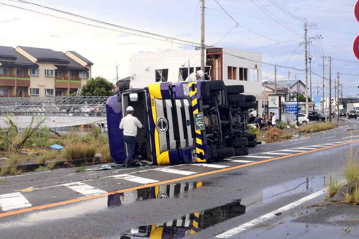
A possible tornado swept across central Shizuoka Prefecture on the afternoon of 5 September, carving a path of destruction as it went. In the city of Makinohara, witnesses reported cars being overturned, power poles knocked down, and buildings damaged. A local hospital admitted around twenty people with injuries thought to have been inflicted by the fierce winds.

In Shizuoka and Ibaraki , several cars were overturned.


 japannews.yomiuri.co.jp
 japannews.yomiuri.co.jp
At 2:25 p.m., lightning generated in the bad weather conditions hit a Jetstar Japan Co. flight en route to Fukuoka, the low-cost carrier said. The plane returned to Narita Airport in Chiba Prefecture about an hour later for inspection. None of the 222 passengers or seven crew members was injured. As of 3:30 p.m., torrential rain continued to fall in eastern Kanagawa Prefecture, leading the JMA to issue a heavy rain alert to the affected areas. Linear rainbands also formed in central and western Shizuoka Prefecture at around 1 p.m. About 120 mm of rain reportedly fell from noon to 1 p.m. near Kakegawa and Makinohara in the prefecture. Linear rainbands may form over the Tokai and Kanto-Koshin regions in the evening. The JMA has forecast a maximum 200 mm of rain in the Kanto-Koshin region, 150 mm in the Tokai region and 80 mm in the Tohoku region for the 24-hour period until noon on Sept. 6. Typhoon No. 15 had a central atmospheric pressure of 994 hectopascals, with maximum instantaneous wind speeds near the center reaching 82.8 kph and gusts of 126 kph as of 2 p.m. on Sept. 5.
A possible tornado swept across central Shizuoka Prefecture on the afternoon of 5 September, carving a path of destruction as it went. In the city of Makinohara, witnesses reported cars being overturned, power poles knocked down, and buildings damaged. A local hospital admitted around twenty people with injuries thought to have been inflicted by the fierce winds.
A building with its outer wall torn off in the Hosoe district of Makinohara, Shizuoka Prefecture (via X)
In Shizuoka and Ibaraki , several cars were overturned.
2 Cars Overturned near Station in Ibaraki Pref. Apparently Due to Sudden Gust of Wind
<p>Two cars were overturned in a parking lot in front of a JR station in Hitachi, Ibaraki Prefecture, on Friday afternoon apparently due to strong winds.</p>
japannews.yomiuri.co.jp
Strong Winds in Central Shizuoka Pref. Overturn Truck, Blow Away Signboard
<p>A tornado and other violent gusts of wind are believed to have struck central Shizuoka Prefecture on Friday afternoon, the Japan Meteorological Agency said.</p>
japannews.yomiuri.co.jp


