

- Thread starter
- #51
Northern Hiroshima, river bank and forest preserve area
I am visiting Hiroshima today, on the river-front, Northern area of the City, with the Eastern side showing some form of preserve or park.
Virtually every 50 feet of these green areas shows some ancient astronomical alignment, geoglyphs, or altar structures. I have attempted to square off what appears to be a temple complex overgrown by vegetation, to the East and slight North.
Given my limited understanding of what these astronomical markings mean, or when they were constructed, I have to make the observation that they match the ocean floor Venus arrangements and stone circle similarities, with an age deep into antiquity. (I am guessing at 2000 BC or previous)
The bottom line is that every piece of green space, whether in the river channel or in the forest preserve, shows heavy altar or shrine locations, with many ancient human habitat indicators.
First view, large scale, positioning Hirohshima on the southern side of Japan.
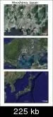
Second view, northern portion of Hiroshima, with blue arrows added where I found riverbank altars, shrines, and astronomical alignment points. A University will find much of antiquities and history in this area, I believe.
http://img410.imageshack.us/my.php?image=222hiroarrows555lw1.gif
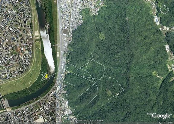
Third view, riverbend area and Eastern forest Preserve area, showing major concentrations of stellar convergence points, altars, and habitat areas. There are so many temple, altar, and geoglyph indicators under the vegetation, I have limited my markings for an easier view.
http://g.imageshack.us/g.php?h=45&i=333hiro50feet555zg5.gif
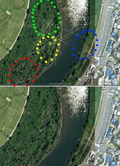
Fourth view, explicit riverbend area, with stellar alignments and stone circle indicators, matching previous ツ"megalithic, Stonehenge-eraツ" stellar alignment points, and apparent Venus grid.
http://g.imageshack.us/g.php?h=59&i=444hiroclose666ty5.gif
Every naturally green area I look at, in Japan, is similarly marked.
Google Earth map of locationツ…
Google Maps
I am visiting Hiroshima today, on the river-front, Northern area of the City, with the Eastern side showing some form of preserve or park.
Virtually every 50 feet of these green areas shows some ancient astronomical alignment, geoglyphs, or altar structures. I have attempted to square off what appears to be a temple complex overgrown by vegetation, to the East and slight North.
Given my limited understanding of what these astronomical markings mean, or when they were constructed, I have to make the observation that they match the ocean floor Venus arrangements and stone circle similarities, with an age deep into antiquity. (I am guessing at 2000 BC or previous)
The bottom line is that every piece of green space, whether in the river channel or in the forest preserve, shows heavy altar or shrine locations, with many ancient human habitat indicators.
First view, large scale, positioning Hirohshima on the southern side of Japan.

Second view, northern portion of Hiroshima, with blue arrows added where I found riverbank altars, shrines, and astronomical alignment points. A University will find much of antiquities and history in this area, I believe.
http://img410.imageshack.us/my.php?image=222hiroarrows555lw1.gif
Third view, riverbend area and Eastern forest Preserve area, showing major concentrations of stellar convergence points, altars, and habitat areas. There are so many temple, altar, and geoglyph indicators under the vegetation, I have limited my markings for an easier view.
http://g.imageshack.us/g.php?h=45&i=333hiro50feet555zg5.gif
Fourth view, explicit riverbend area, with stellar alignments and stone circle indicators, matching previous ツ"megalithic, Stonehenge-eraツ" stellar alignment points, and apparent Venus grid.
http://g.imageshack.us/g.php?h=59&i=444hiroclose666ty5.gif
Every naturally green area I look at, in Japan, is similarly marked.
Google Earth map of locationツ…
Google Maps


