Question Japan- China Silk Map

Jags1

Kouhai
Joined
2 Oct 2018
Messages
83
Reaction score
11
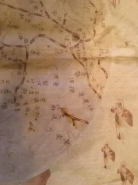
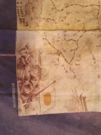
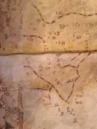
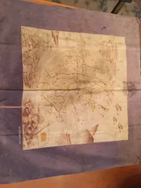
I have a silk map that appears to be a Japanese "war" map of a city in China showing streets but this is a guess on my part. Pre-WW2 as it has "bi-planes"?
Really appreciate any help on this.
 

Attachments

  • IMG_1429.webp
    IMG_1429.webp
    197.7 KB · Views: 220
  • IMG_1428.webp
    IMG_1428.webp
    231.6 KB · Views: 211
  • IMG_1427.webp
    IMG_1427.webp
    319.3 KB · Views: 212
  • IMG_1426.webp
    IMG_1426.webp
    417.7 KB · Views: 230
  • IMG_1425.webp
    IMG_1425.webp
    279.7 KB · Views: 207
  • IMG_1424.webp
    IMG_1424.webp
    168.6 KB · Views: 223
The pictures are rotated 90 degrees to the right.
It's not a map of a city, but a map of China. The black-white lines symbolize "railroad", and kanji shows location names (city, mountain, river or bay).
 
The pictures are rotated 90 degrees to the right.
It's not a map of a city, but a map of China. The black-white lines symbolize "railroad", and kanji shows location names (city, mountain, river or bay).

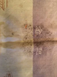
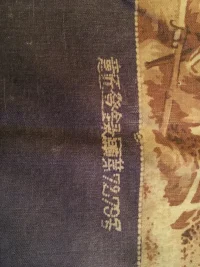
Wow... Do you have any idea what the meaning is of the Kanji in picture #1426 or the two symbols at the top of #1425? Do you think this was part of the "invasion" plan by Japan?
Really appreciate the help! Very interesting to say the least
 
top
Memorial
bottom
Registered Design No.7279

It's just a souvenir or something. (Seems like a furoshiki to me.)
 
Back
Top Bottom