


- 14 Mar 2002
- 21,050
- 18,903
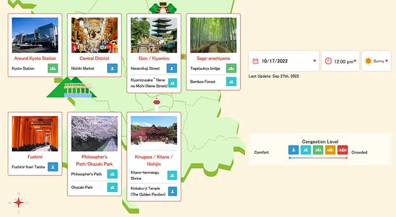
The Kyoto Municipal Government and the Kyoto City Tourism Association launched an online map in English and Chinese showing crowding forecasts for the ancient Japanese capital's sightseeing hotspots.
I like the live cams in particular.

 global.kyoto.travel
In addition to the multilingual versions of the "Kyoto Travel Congestion Forecast" map, the city and tourism association began boosting messaging to inbound travelers before the Japanese government drastically eased pandemic border restrictions on Oct. 11. They are promoting ease of travel in Kyoto while preventing "overtourism," or overwhelming numbers of visitors going to certain spots. The map allows users to check five-level congestion forecasts every hour up to two months in advance for seven popular tourist areas, including "Gion and Kiyomizu," "Saga-arashiyama" and "Fushimi." The forecast is based on analysis of past smartphone location data, and promises to make it easier for visitors to see the major sights while avoiding congested times.
I like the live cams in particular.
Kyoto Travel Congestion Forecast
We provide congestion information by area, predicted based on big data. Please enjoy comfortable sightseeing in Kyoto by referring to the live streaming.


